Explore congressional district demographic data in a spreadsheet. This dataset provides a list of all U.S. congressional districts for the U.S. House of Representatives with their state, county, and metro area. It also has detailed income by congressional district and U.S. Census data for age, gender, and race. Explore for free in Row Zero, a next-gen spreadsheet built for big data.
Dataset Summary
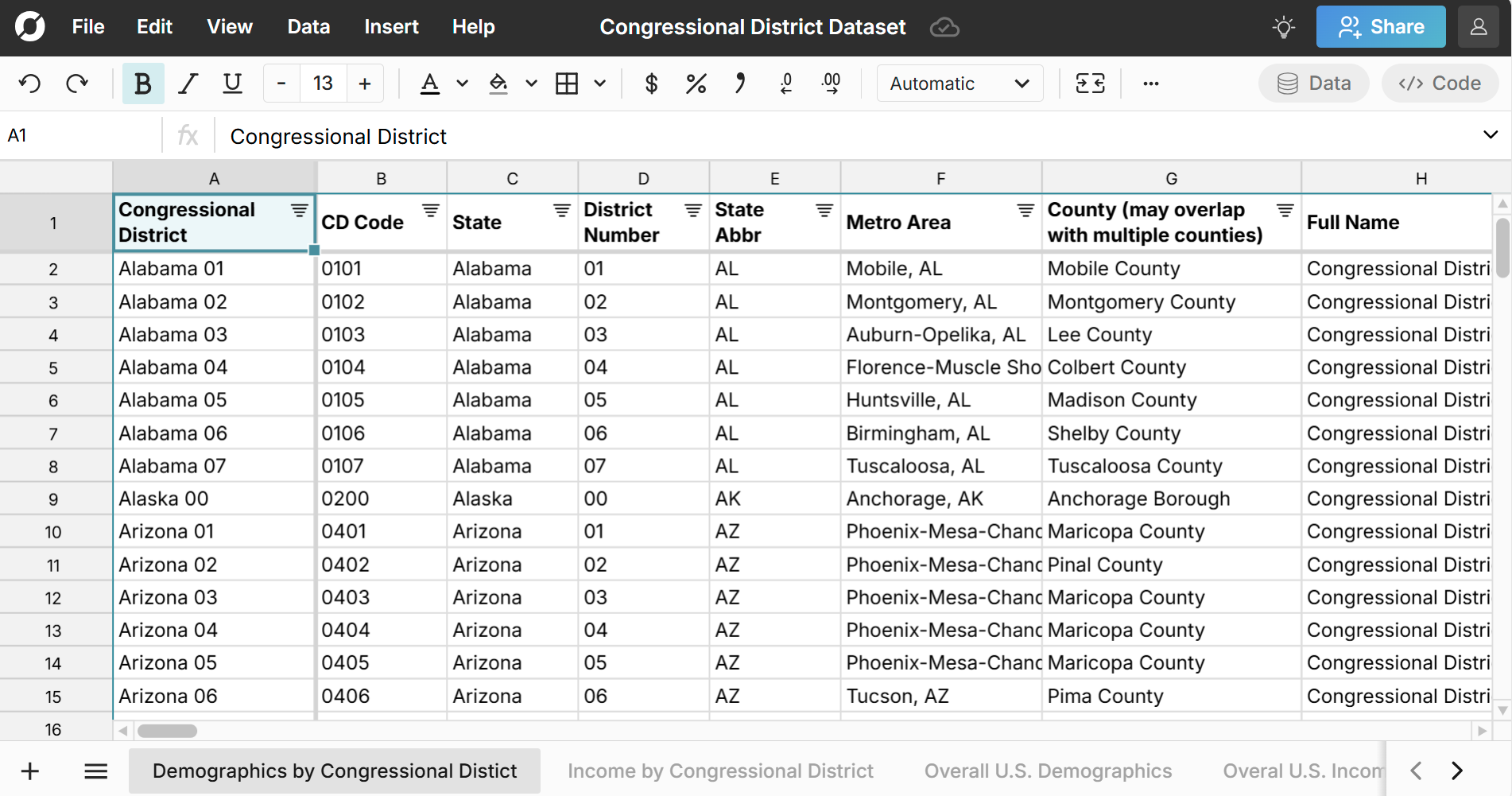
The Congressional District Dataset contains the following sheets:
- Demographics by Congressional District
- Income by Congressional District
- Map Zip to Congressional District
- Map Congressional District to ZIP
- Overall U.S. Demographics
- Overall U.S. Income
This spreadsheet includes several different sheets of congressional district data from the U.S. Census Bureau. It also includes mappings of each congressional district to county, metro, and state.
The dataset includes all 435 U.S. Congressional Districts as well as the Delegate District for the District of Columbia and the Resident Commissioner District for Puerto Rico.
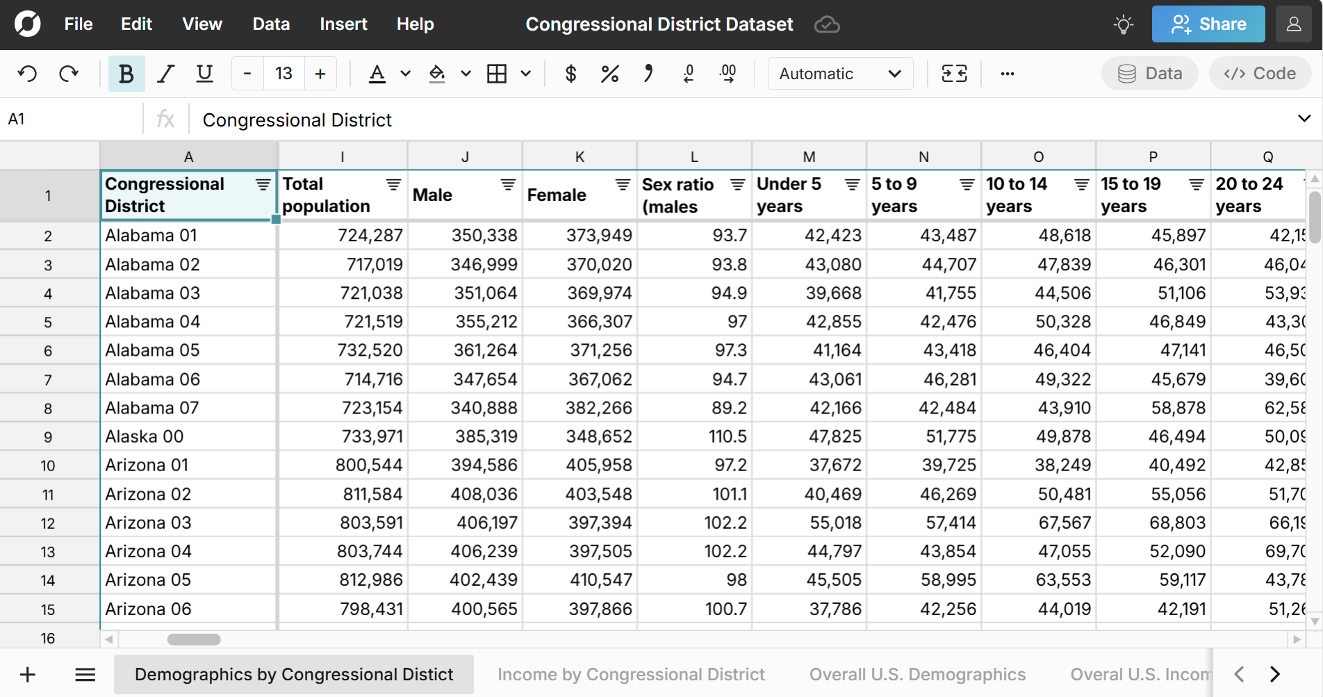
Congressional District Age and Gender Breakdown
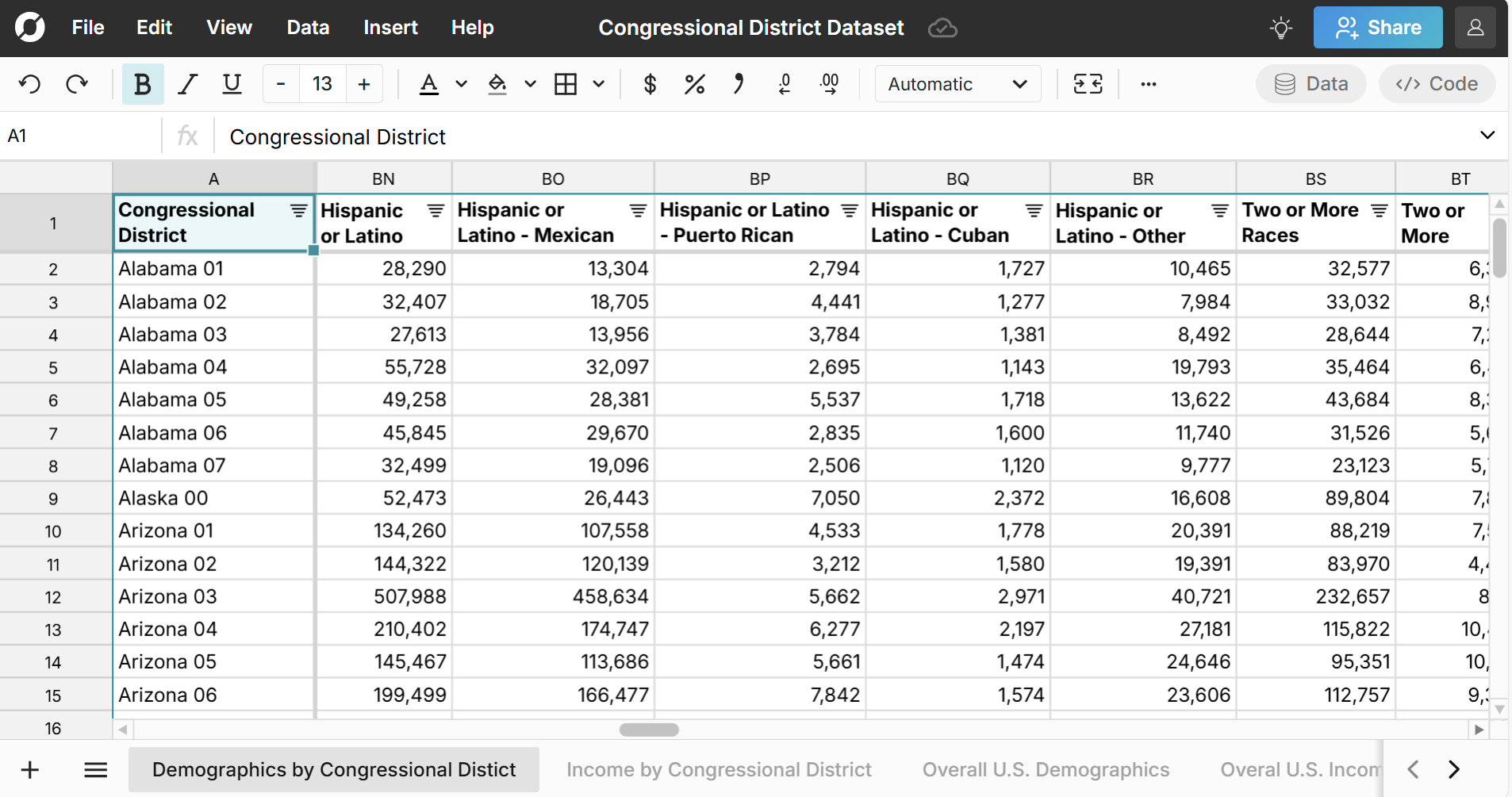
The Demographics by Congressional District sheet includes congressional district population by age and gender with both raw counts and percentages.
Congressional District Race Breakdown
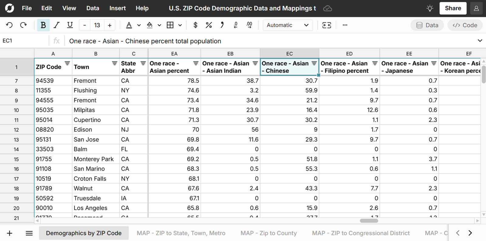
The Demographics by Congressional District sheet also includes race breakdown by congressional district with both raw counts and percentage breakdowns for single race and multiracial residents.

The race breakdown for each congressional district includes:
- White
- Black or African American
- American Indian and Alaska Native
- Aztec
- Blackfeet Tribe
- Maya
- Barrow Inupiat
- Navajo Nation
- Nome Eskimo
- Other
- Asian
- Asian Indian
- Chinese
- Filipino
- Japanese
- Korean
- Vietnamese
- Other
- Native Hawaiian and Other Pacific Islander
- Chamorro
- Native Hawaiian
- Samoan
- Other
- Hispanic or Latino (of any race)
- Mexican
- Puerto Rican
- Cuban
- Other
Congressional District Income Breakdown
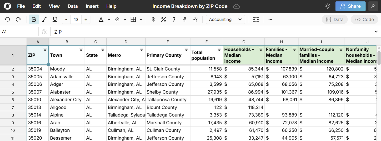
The Income by Congressional District sheet includes congressional district median household income, mean income, and family income by district.

The income breakdown for each congressional district includes counts and percentage for the following income brackets:
- Less than $10,000
- $10,000 to $14,999
- $15,000 to $24,999
- $25,000 to $34,999
- $35,000 to $49,999
- $50,000 to $74,999
- $75,000 to $99,999
- $100,000 to $149,999
- $150,000 to $199,999
- $200,000 or more
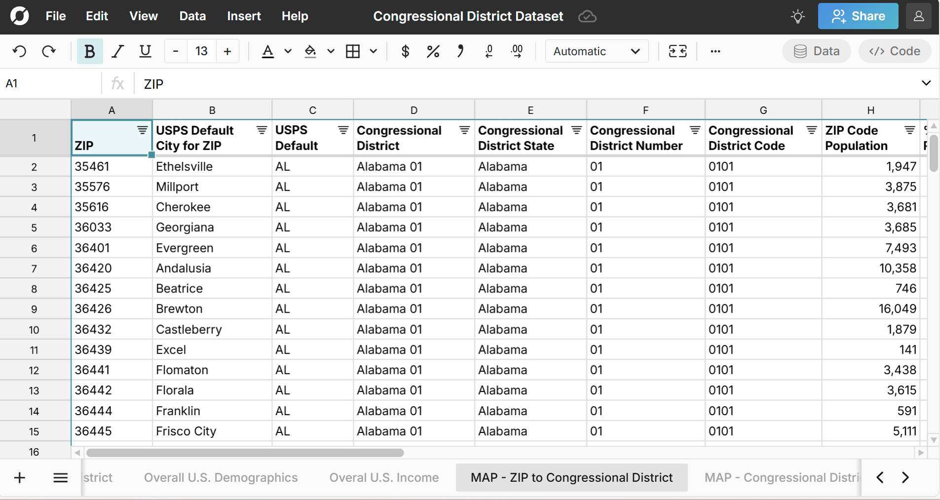
ZIP Code to Congressional District Mapping
The MAP - ZIP to Congressional District sheet maps the list of all U.S. ZIP codes to their congressional districts and includes the percent of the ZIP code population in each congressional district, since some ZIP codes map to multiple congressional districts.
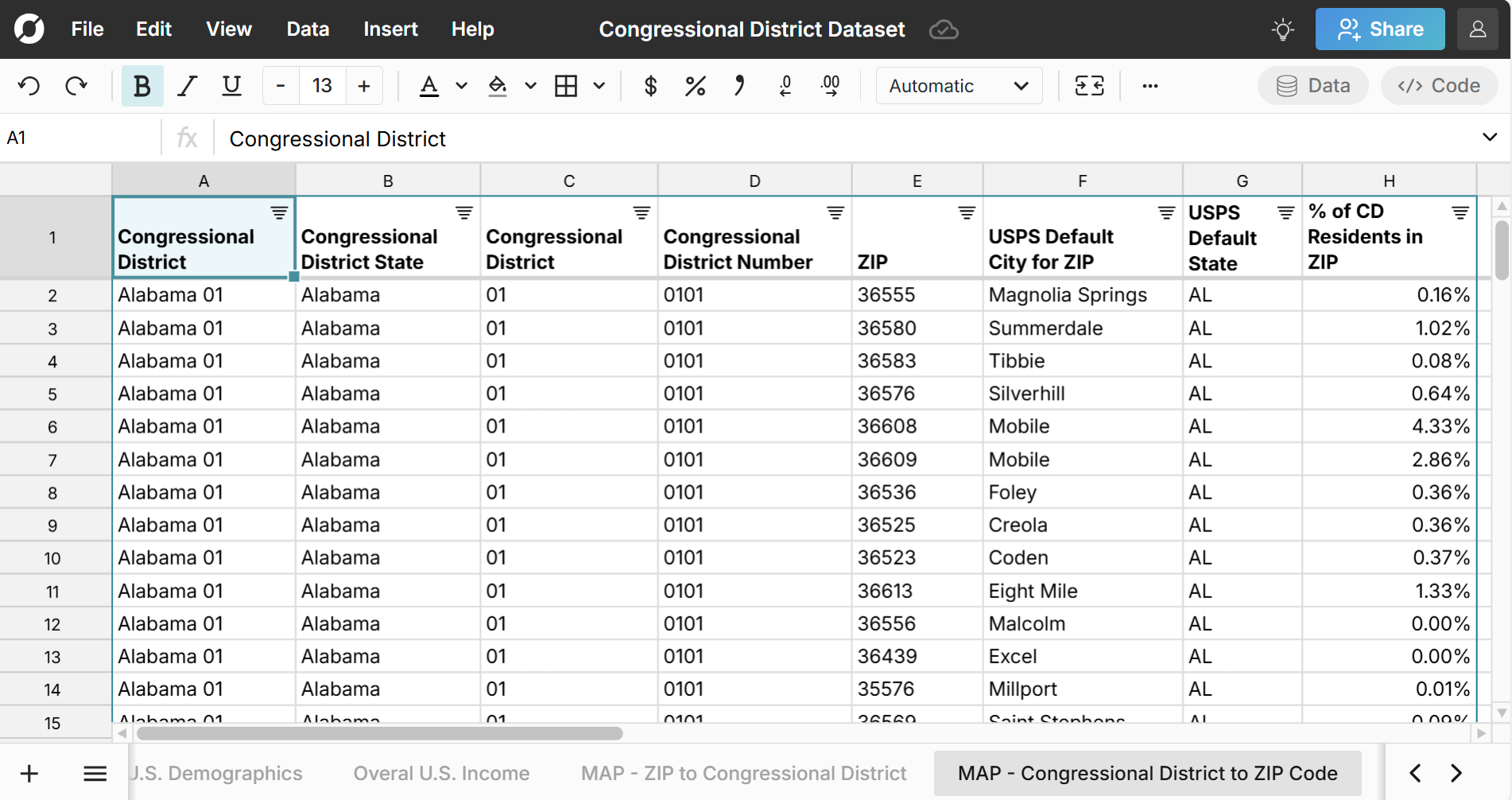
Congressional District to ZIP Code Mapping
The MAP - Congressional District to ZIP sheet lists the ZIP codes in each congressional district and includes the percent of the congressional district in each ZIP code so you can sort the largest ZIP codes in each congressional district.
Use Cases for this Dataset
Row Zero is a powerful spreadsheet built for big data, so you can easily import your data into the congressional district spreadsheet (or vice versa) to enrich your data or just start exploring the congressional district dataset with charts and pivot tables. Here are a few common use cases:
- Look up your congressional district by ZIP code and explore the demographics of your congressional district.
- Join the congressional district datasets with voting results to analyze election data. You can use XLOOKUP to join datasets or import congressional district data directly to your database or data warehouse.
- Rank congressional districts on demographic characteristics like age, gender, race, and income.
- Develop a political campaign strategy based on voter characteristics in each congressional district.
Data Sources
Data sources for this ZIP code demographics dataset include the U.S. Census Bureau 5-year estimate tables from the American Community Survey, as well as the U.S. Office of Housing and Urban Development. Data has been updated as of February 2025 with the most recent data available.
Frequently Asked Questions
A U.S. congressional district is a geographic area within a state that elects a representative to the U.S. House of Representatives. Each district is designed to have approximately equal population, ensuring equal representation in Congress. The number of districts per state is determined by the decennial U.S. Census.
There are 435 Congressional Districts across the 50 U.S. states. In addition, DC is a Delegate District and Puerto Rico is a Resident Commissioner District.
Yes, the congressional district spreadsheet provides free congressional district demographic data from the U.S. Census. Sign up for free to make full use of the data in Row Zero. To export the data to your data warehouse or download a CSV of congressional district data, you'll need to sign up for a Pro account.