This spreadsheet maps ZIP codes to places in the U.S. and includes several different sheets of ZIP code crosswalks. For all U.S. ZIP codes, you can lookup the primary town, state, county, and metro area. You can also lookup all towns a ZIP code overlaps with. Explore for free in Row Zero, a powerful spreadsheet built for big data.
Dataset Summary
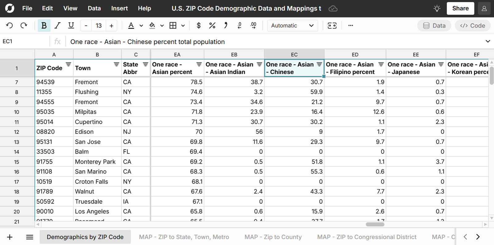
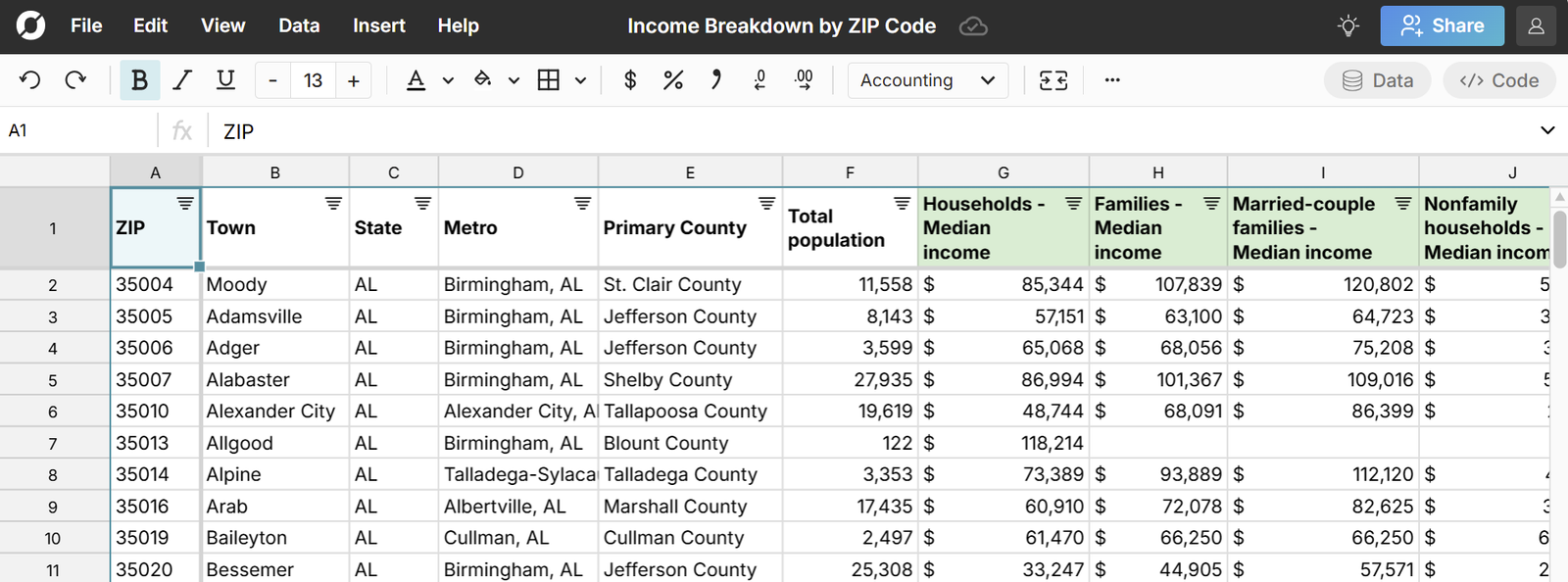
This free ZIP code spreadsheet includes several different sheets of ZIP code to place crosswalks using data from the U.S. Census Bureau and U.S. Office of Housing and Urban Development. You can uses these crosswalks to easily map ZIP codes to towns, cities, states, counties, metro areas, etc. The dataset also includes FIPS codes for each place, which are standard geographic codes that can be used to look up U.S. locations across location datasets. Note that this dataset generally uses ZIP code tabluated areas (ZCTAs) which are ZIP codes of populated areas with geographic boundaries and does not include PO BOX ZIP codes.
Here are the sheets included in the dataset:
- ZIP to Congressional Districts
- ZIP to Census Places
- ZIP to County Subdivisions
- List of ZIP Codes by County
- List of ZIP Codes by Metro Area
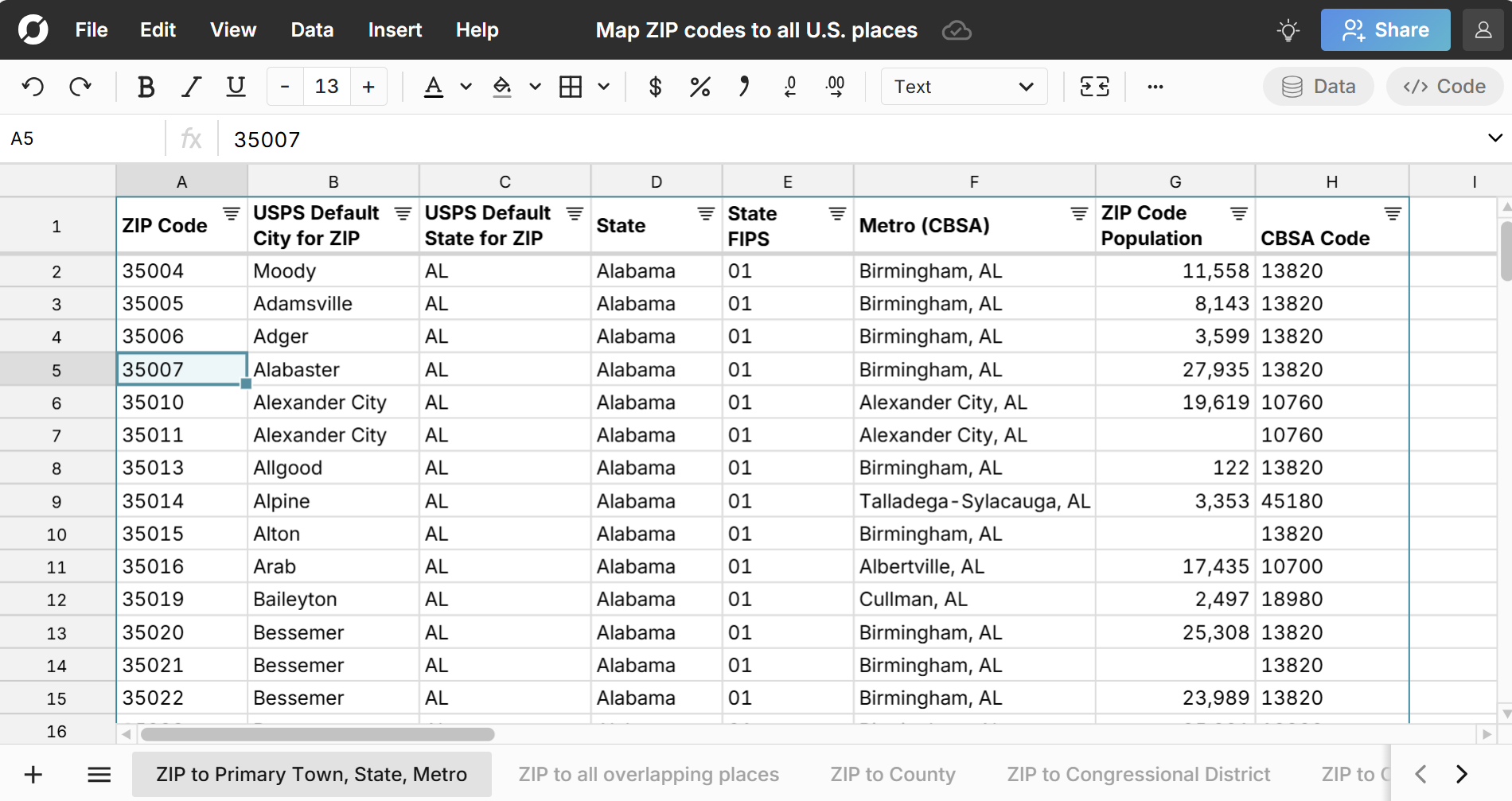
ZIP to Primary Town, State, Metro
The ZIP to Primary Town, State, Metro sheet includes a list of all U.S. ZIP codes with their primary town, state, and metro area.
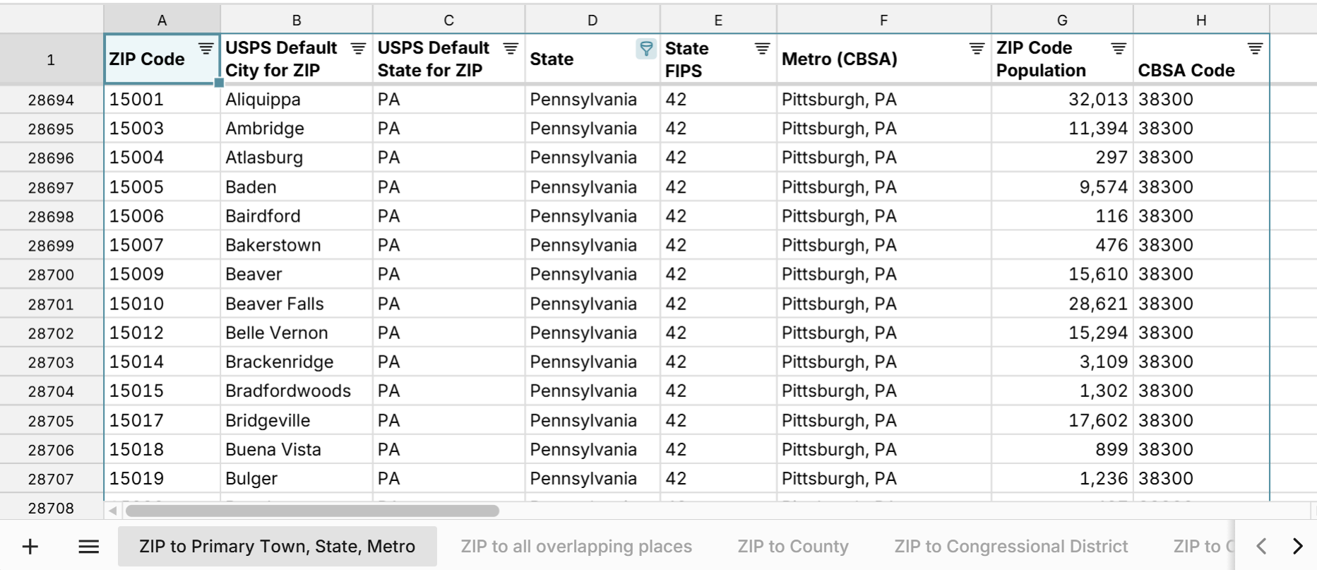
This sheet has one ZIP code to town mapping for each ZIP code. To lookup all towns a ZIP code overlaps with, use the sheet below.
ZIP Code to All Overlapping Places
The ZIP to all overlapping places sheet includes a list of all U.S. ZIP codes and all towns and cities they overlap with. Many ZIP codes overlap with multiple towns and places. There is one row for each combination of ZIP code and place.
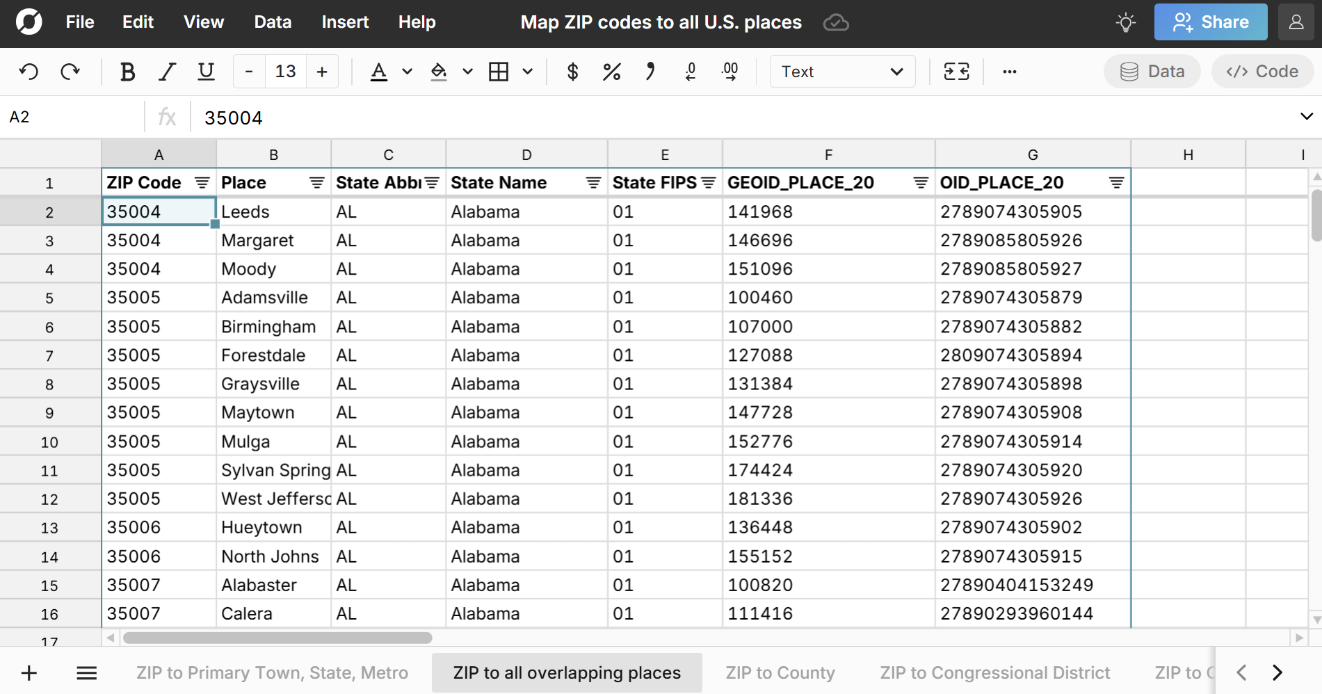
Note that this sheet includes a curated and deduplicated list of real-world U.S. places using a combination of both the ZIP to Census Places datasets and ZIP to County Subdivisions datasets. Alone, the Census Places and County Subdivision datasets fail to adequately capture all real-world places in the U.S. and have significant duplication across them. We've included the curated list along with the original full datasets of ZIP to Census Places and ZIP to County Subdivisions below so you can choose whichever dataset meets your needs.
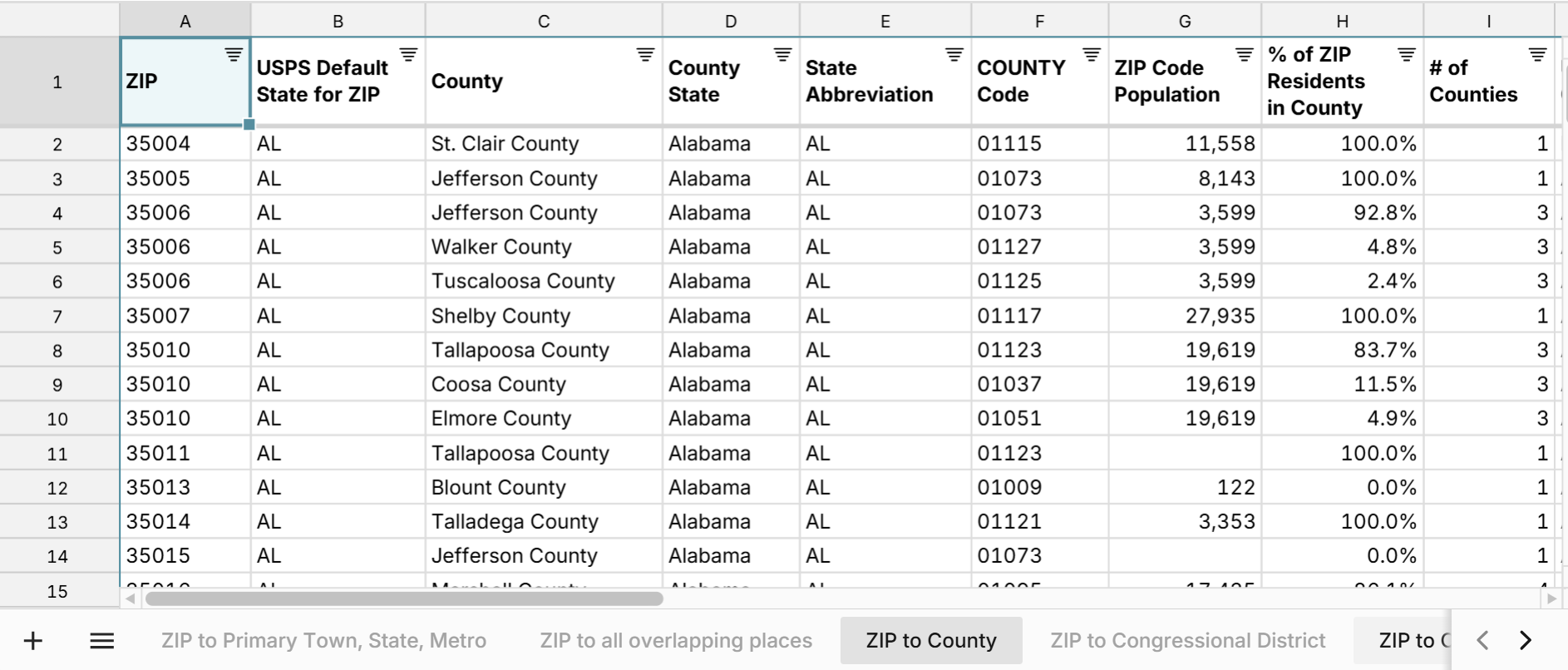
ZIP Code to County
The ZIP to county sheet includes each ZIP code to county mapping. Note that some ZIP codes overlap with multiple counties. In these cases there will be multiple rows for the ZIP code - one for each county it overlaps with. To help better evaluate these, there is a column for % of ZIP residents in county and # of counties a ZIP overlaps with so you can accomodate these multiple county ZIP codes.
ZIP Code to Congressional District
The ZIP to Congressional District sheet includes each ZIP code to congressional district mapping. Note that some ZIP codes overlap with multiple congressional districts. As with counties above, there are columns for % of ZIP residents in CD and number of CDs so you can identify these. If you want to look up all ZIP codes in a Congressional District, use the Congressional District to ZIP sheet.
ZIP Code to Census Places
The ZIP to Census Places sheet maps each ZIP code to every Census Place that it overlaps with. Note that Census Places do not have full coverage of all U.S. locations and sometimes conflict with County Subdivisions below. As a result, we recommend using the curated sheet of ZIP to places above which attempts to account for this.
ZIP Code to County Subdivisions
The ZIP to County Subdivisions sheet maps each ZIP code to every County Subdivision that it overlaps with. Like Census Places above, County Subdivisions do not have full coverage of all U.S. locations and sometimes conflict with Census Places, so we recommend using the curated sheet of ZIP to places, unless you explicitly want to limit to County Subdivisions.
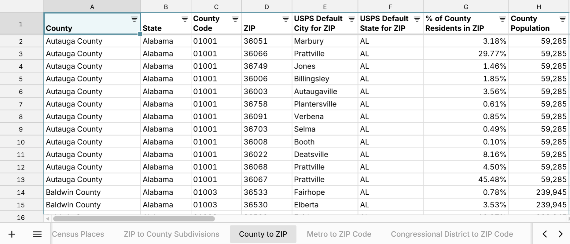
List of ZIP Codes by County
The County to ZIP sheet lets you lookup a list of ZIP codes by county and includes a column for % of County Residents in ZIP code so you can see which ZIP codes contribute the most to a county's population.
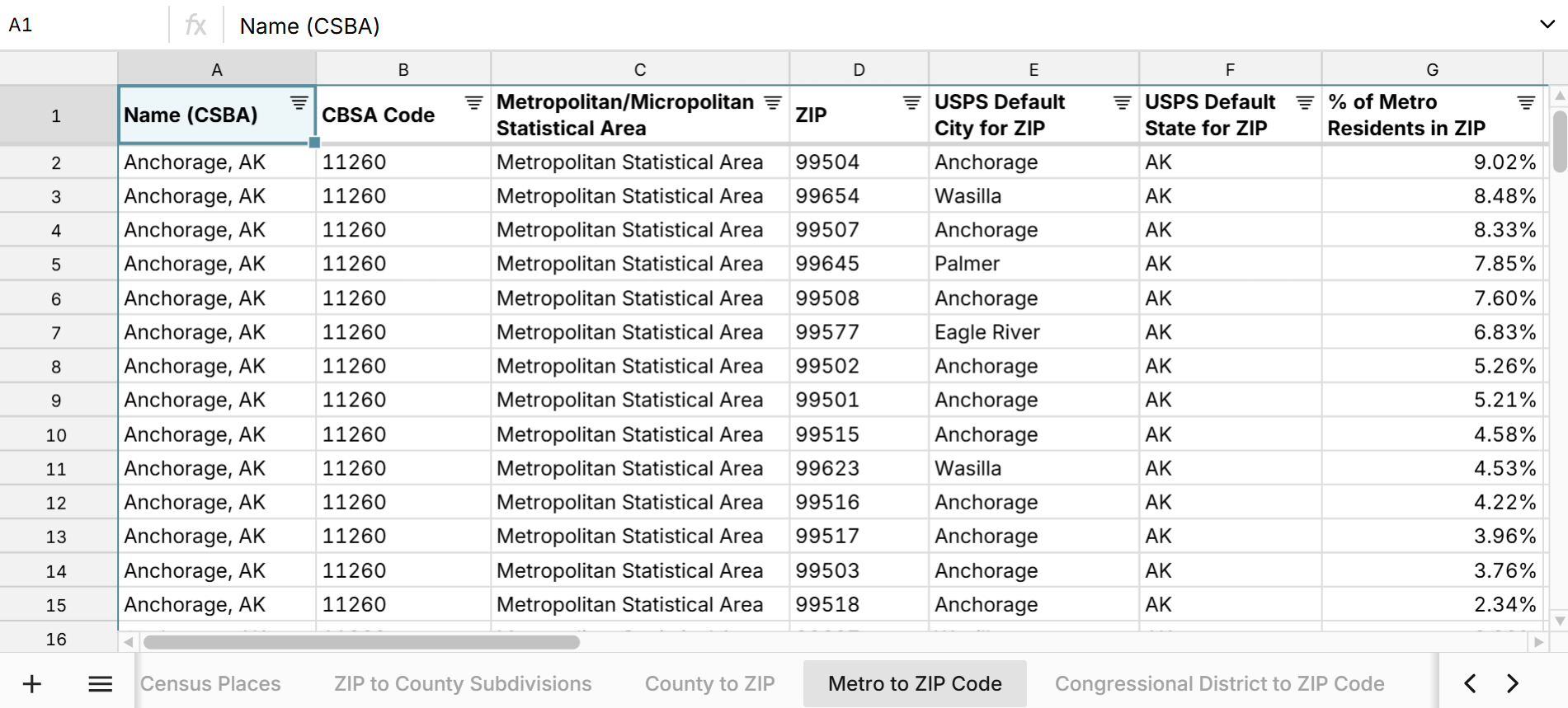
List of ZIP Codes by Metro Area
The Metro to ZIP sheet lets you lookup a list of ZIP codes by metro area and includes a column for % of Metro Residents in ZIP code so you can see which ZIP codes contribute the most to a metro area's population.
Note you can filter the first sheet in the spreadsheet by state to get a list of all ZIP codes by state.
Use Cases for this Dataset
Row Zero is an enterprise-grade spreadsheet built for big data, so you can easily import your data into this ZIP code spreadsheet (or vice versa) to map your data or just start exploring this comprehensive ZIP code lookup. Here are a few common use cases:
- Enrich your current datasets with U.S. places data. You can use XLOOKUP to map ZIP codes to any location level
- Import the ZIP code crosswalks data directly to your database or data warehouse, so that you can enrich any ZIP code data in your data warehouse. Row Zero supports write-back to your data warehouse. You can connect to Snowflake, Databricks, Redshift, Postgres, and more.
- Look up all places that a ZIP code overlaps with. In particular, it can be a challenge to find a list of all towns a ZIP code overlaps with, without using complicated GIS software and mapping boundaries. This spreadsheet makes it very easy to view all places a ZIP overlaps with.
Data Sources
Data sources for ZIP code dataset include the U.S. Census Bureau 5-year estimate tables from the American Community Survey, as well as the U.S. Office of Housing and Urban Development. ZIP codes included in the spreadsheet are generally ZIP Code Tabulated Areas (ZCTAs) which are ZIP codes of populated areas. It generally does not include ZIP codes of PO boxes. Data has been updated as of March 2025 with the most recent data available.
Frequently Asked Questions
Yes, ZIP codes can overlap with multiple counties. The spreadsheet included here has one row for each ZIP to county mapping.
Yes the ZIP code spreadsheet included here has a list of all towns a ZIP code overlaps with. There is one row for each mapping of ZIP code to town.
Yes ths USPS assigns a default city for each ZIP code. The spreadsheet include here has sheet for both primary town and all overlapping towns.
FIPS codes (Federal Information Processing Standards) are unique codes used to identify U.S. geographic locations. You can use city FIPS codes and town and place FIPS codes to map city data across location datasets.
Yes, the ZIP code spreadsheet is free to use and provides crosswalks between ZIP codes and all U.S. locations. Sign up for free to make full use of the data in Row Zero. To export the data to your data warehouse or download a CSV of the ZIP code data, you'll need to sign up for a paid Pro account.