This spreadsheet includes a list of all U.S. counties with their county FIPS codes and state FIPS codes, as well as the county population. You can easily filter and sort to see the largest counties by state. The spreadsheet also maps county FIPS to ZIP codes. Explore the County FIPS code spreadsheet for free in Row Zero, a powerful spreadsheet built for big data.
County FIPS Dataset Summary

This free county FIPS code spreadsheet includes multiple sheets of FIPS state and county codes as well as ZIP codes by county. The data and FIPS code crosswalks are sourced from the U.S. Census Bureau and U.S. Office of Housing and Urban Development. You can use these crosswalks to easily map county FIPS codes to state FIPS codes, filter to a list of all counties by state, or as a bulk FIPS county code lookup.
Here are the sheets included in the dataset:
If you want to additional county data, view the county demographic data set.
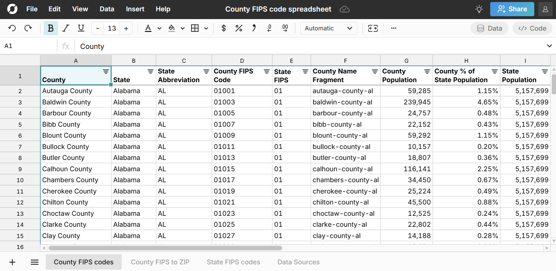
County FIPS code list
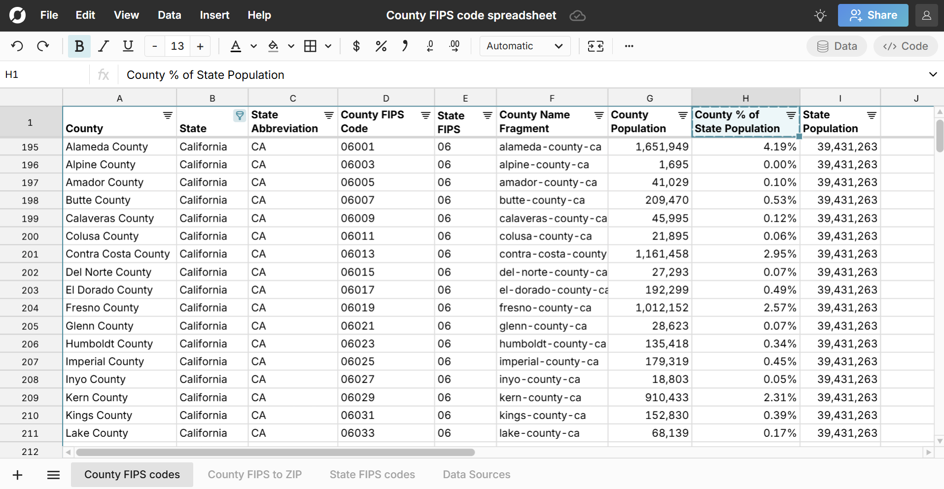
The County FIPS code sheet includes a list of all U.S. counties with their state. The sheet includes county and state FIPS codes, so you can easily crosswalk county FIPS codes to state FIPS codes. Note that the first two digits of the county FIPS code is the state FIPS code. The sheet also includes County Population, State Population, and County % of State Population, so you can easily look up largest counties by state.
What is a county FIPS code?
A county FIPS code is a unique five-digit code assigned to each county in the U.S. The first two digits of a county FIPS code represent the state FIPS code, and the last three digits represent the specific county within that state. FIPS codes (Federal Information Processing Standards) are unique codes used to identify U.S. geographic locations including counties, states, and places. View place FIPS codes here.
County FIPS to ZIP code
The County FIPS to ZIP sheet maps county FIPS codes to ZIP codes with one row for each combination of county and ZIP code. Note that some ZIP codes map to multiple counties. The sheet includes a column for '% of County Residents in ZIP' so you can sort to see the largest ZIP codes by county in terms of the ZIP code's contribution to the county's population.

You can use this sheet to filter to a list of ZIP codes in each county. If you want to go in the reverse direction and map ZIP codes to county FIPS codes, use the ZIP code to county FIPS codes dataset.
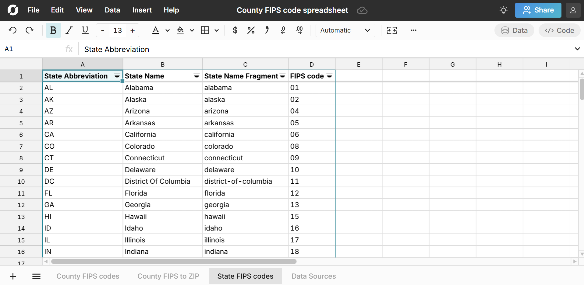
State FIPS codes
The State FIPS codes sheet includes a list of all U.S. states with their full state name, state abbreviation, state FIPS code, and population.
Use Cases for this Dataset
Row Zero is a spreadsheet for big data, so you can easily import your data into this county FIPS code spreadsheet (or vice versa) to map your data or just start exploring the data with filter, sort, functions, pivot tables, charts, etc. Here are a few common use cases:
- Enrich your current datasets with county or state data. FIPS codes give you a common unique identifier to connect location datasets. You can use XLOOKUP to map FIPS county and state codes across multiple datasets.
- Import the list of county FIPS codes and the county to state FIPS codes crosswalk data directly to your database or data warehouse, so that you can normalize county and state data in your data warehouse. Row Zero supports write-back to Snowflake, Databricks, Redshift, Postgres, and more.
- Use filter, sort, and search to lookup county FIPS codes, sort largest counties by state, or filter to a list of ZIP codes by county.
Data Sources
Data sources for this county FIPS code dataset include the U.S. Census Bureau 5-year estimate tables from the American Community Survey, as well as the U.S. Office of Housing and Urban Development. ZIP code population is included for ZIP Code Tabulated Areas (ZCTAs) which are ZIP codes of populated areas. Data has been updated as of September 2025 with the most recent data available.
Frequently Asked Questions
FIPS codes (Federal Information Processing Standards) are unique codes used to identify U.S. geographic locations. Each U.S. state, county, and place has a FIPS code assigned.
The U.S. Census Bureau assigns and maintains FIPS codes are the primary user of FIPS codes for geographic identification. The American National Standards Institute (ANSI) is also responsible for maintaining FIPS codes in conjunction with its own Geographic Names Information System (GNIS).
Yes, the county FIPS code preadsheet is free to use and provides crosswalks between state and county FIPS codes as well as county FIPS codes to ZIP codes. Sign up for free to make full use of the data in Row Zero. To export the data out of Row Zero, you'll need to sign up for a paid Pro account.
County FIPS codes are unique 5 digit indentifiers assigned to each county by the U.S. Census and are used as unique county indentifiers to support connecting county data across multiple datasets. Some folks refer to them as census county codes.
There are more than 3,000 counites in the U.S. The specific number can vary depending on whether you include 'county equivalents' and U.S. territories, with numbers ranging from 3,143 counties to 3,244 when including county equivalents and U.S. territories.